

In A Nutshell
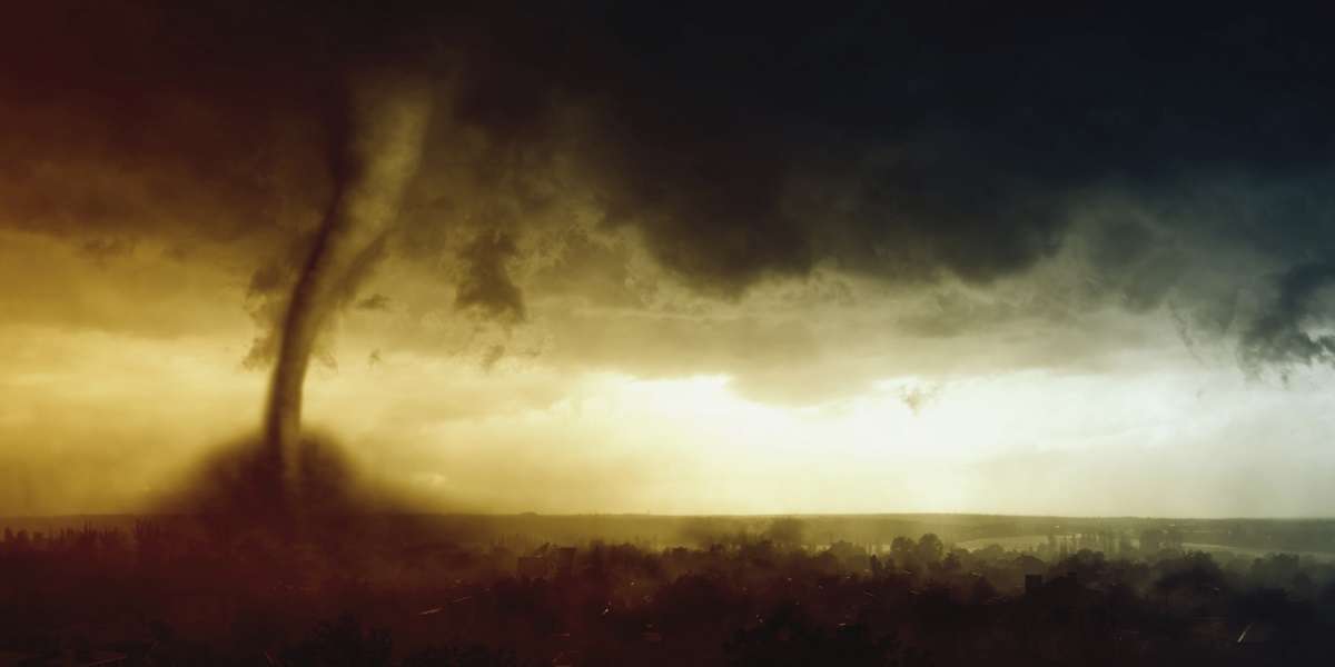
In 1974, the word “outbreak” took on a whole new (though no less deadly) connotation when there was a massive outbreak of tornadoes in the Midwestern United States. In a matter of 15 hours, 148 separate tornadoes left a path of destruction over 13 states. At the end, hundreds of people were dead, thousands injured, and the damage was estimated at around half a billion dollars.
The Whole Bushel


Usually when we hear the word “outbreak,” it’s associated with something like the flu. That’s frightening enough, but when it’s a word that’s associated with some devastating weather events, it can be downright terrifying.
In 1974, 148 separate tornadoes touched down in 13 states in the Midwestern United States. This first touched ground in Tennessee and Georgia at around 2:00 PM on April 3, and dozens more were seen within hours across a massive pathway from Alabama and Mississippi to Michigan and Indiana.
Of the 148, 88 were classified as F2 tornadoes, meaning that their average wind speed was between 178–217 kilometers per hour (111–135 mph). Six of them were F5 tornadoes, meaning their wind speeds topped 321 kilometers per hour (200 mph)—and that’s the most severe the Fujita scale for tornado classification gets.
By comparison, there were 1,100 tornadoes reported in the entire country through all of 1973, and only one of them was an F5.
The tally on the final destruction varies from source to source. What is agreed on is that more than 300 people were dead, more than 6,000 severely injured, and the overall damage was estimated at around half a billion dollars—give or take a few hundred million.
According to eyewitnesses, houses simply exploded with sounds like fighter jets taking off nearby. In some places, there was no way to see the telltale funnel that most people identify with a tornado; it was nothing more than black, swirling debris. The town of Martinsburg, Indiana seemed to just disappear. Train cars and school buses were thrown around like toys and demolished buildings in seconds.
The tornadoes were so close to each other that some converged and combined; three did exactly that at 4:30 PM over a home in Ohio. The combined tornado went on to almost completely destroy the town of Xenia. Those that survived with injuries were the fortunate ones, and survivors of the Xenia tornado recalled seeing several of their neighbors swept up into the swirling, massive vortex that had become the sky.
So how does something like that happen?
Three different weather phenomena, all pretty harmless on their own, converged over the luckless states to create the massive tornado outbreak. A front of warm, damp air was moving north from Mexico and converged with a front of cold, dry air from Canada; throw in a jet stream traveling at 225 kilometers per hour (140 mph), and you get an outbreak of tornadoes.
It was this devastating weather phenomenon that resulted in a massive update to the technology available to the National Weather Service. At the time, they were still using radar technology that had been developed during World War II. Seeing a blip on radar didn’t instantly mean anything then, and it wasn’t considered an official tornado until someone physically saw it. The deadliest of all of the outbreak tornadoes, the one that hit Xenia, Ohio, didn’t even show up on the radar. Even if it had, it might not have mattered. At the time, the only way to read radar was to own the radar equipment itself, as there was no way to send data out to other news or weather agencies. There were only 52 monitoring stations in the country, a number that doubled after the disaster.
Show Me The Proof
Popular Mechanics: Super Tornado Outbreak: Miss. and Ohio River Valleys, April 1974
NOAA and the 1974 Tornado Outbreak
Huffington Post: Tornado Predictions Drastically Improved Since 1974 Super Outbreak
Weather Channel: How are tornadoes categorized?


